

How can you use geodesign to build better cities?


For Mary-Jane (MJ) Wood, geodesign is how we stop guessing and start testing. It creates better places by directly linking design ideas with data and real-time impact modeling.
“Before joining Jacobs, I studied architecture and urban design and spent several years working on regeneration master plans and transformation strategies across Europe and the Middle East,” says MJ. “These projects taught me how to effectively work across disciplines and to see cities as systems with physical form, environmental needs and socioeconomic context intertwined.”
MJ loves the mix of creativity, analytical thinking and people-focused problem-solving in urban design. Geodesign brings engineers, planners, ecologists, communities and clients into the same conversation and shared spatial understanding, leading to common goals and inclusive design decisions.
“Instead of designing first and analyzing later, geodesign brings geographic, environmental and social data into the process from day one,” explains MJ. “We can model outcomes as we sketch — high-level development costs, land use mixes, flood resilience, connectivity and accessibility — and iterate quickly based on evidence.”
That matters because clients are being asked to prove results. They need to show how proposals support net zero and resilience alongside quality of life. Scenario testing empowers teams to see trade-offs early and justify decisions with evidence to avoid late-stage redesign.
Geodesign also changes how people engage. With Geographic Information System (GIS) scenario tools paired with live 3D models and dashboards, stakeholders can explore options together, ask “what if” questions and see impacts in real-time. It accelerates alignment, reducing friction between teams and making engagement clearer because people can react to tangible scenarios instead of abstract drawings.
“It's collaboration on a deeper, data-driven level, giving clients better opportunities to weigh options and understand implications so they can choose a path with confidence,” shares MJ. “One of my career highlights is presenting on this kind of collaboration for the annual Geodesign conference hosted by Environmental Systems Research Institute (Esri).”
Clients want certainty in an uncertain world
MJ describes how clients are navigating climate resilience and social value, accessibility and quality of life outcomes while managing shifting policies and market pressures alongside community expectations.
“They want clarity and confidence that decisions made now will hold up long term,” she says.
Geodesign supports that need by turning complex data into clear evidence for decision making. It enables teams to test assumptions, comparing trade-offs and understanding where risks, costs and opportunities sit before plans move too far ahead. With a shared view of performance, clients can see what drives outcomes, what may need to change and where investment will have the greatest impact.
The project MJ is most proud of was an ambitious regeneration program in the U.K. with many moving parts. Her role focused on leading the digital master planning workstream. She built a bespoke platform that allowed the client and all the teams on the project to see how the masterplan was performing across key metrics. Instead of reviewing static drawings, the team could explore scenarios interactively and test density, connectivity, open space and land use in a transparent way to see how the masterplan was performing across key metrics. Instead of reviewing static drawings, the team could explore scenarios interactively and test density, connectivity, open space and land use in a transparent way.
It also changed how the wider team collaborated: the dashboards became a shared environment where gaps, opportunities and assumptions were visible to everyone. And importantly, we set it up so the client could own and use the model long-term, supporting future phases and ensuring continuity long after our initial work ended. It has also paved the way for other geodesign work in Ireland and the Middle East.
The tools and trends reshaping city-making, and how geodesign connects them
Several shifts are transforming how cities are planned and delivered: geospatial integration from day one, parametric and algorithmic workflows, digital twins and scenario-based planning and collaborative platforms that enable clients to engage with live models rather than static reports.
Parametric and algorithmic workflows are advanced computational approaches that use data, rules and design parameters (like access, land use, density or carbon) to rapidly test options and reveal how changes influence outcomes.
They can be used to identify spatial patterns, risks and delivery pressures across entire development portfolios, giving teams a single, consistent view of multiple projects. By highlighting interdependencies and potential blockers early, they support more coordinated decision‑making, prioritize where attention is needed most, and ultimately streamline delivery to accelerate growth. Technology also makes engagement more inclusive: visualization, summarization and translation tools enable participants to understand complex options and contribute confidently.
AI is part of that ecosystem as it's useful for automation and pattern-finding, and strengthens the link between data, simulation and collaborative design. However, the ultimate goal stays the same: faster, more transparent decisions that lead to inclusive, connected and resilient cities.
And that's where geodesign shines.
-
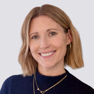
Principal Urban Designer & Geodesign Lead
Mary-Jane Wood is a principal urban designer and geodesign lead at Jacobs. She uses geodesign, a data-led way of testing design choices through geographic information and digital modeling, to support better decisions about places, communities and the built environment.
