


News
TripAdvisor’s 2019 Travelers Choice Awards list. National Geographic’s Best Trips 2019 List. Renowned for its spectacular Mayan ruins, mangrove and palm-fringed islands and direct access to breathtaking reefs such as the Mesoamerican and the Great Blue Hole, Belize frequents travel bucket lists around the world.
Each year, more than 400,000 people come to experience the wonder of Belize, generating up to U.S. $400 million ($800 BZD) according to most recent statistics. The country’s economic engine is primarily concentrated in a handful of popular tourist sites – restricting the growth potential and economy, while threatening the sustainability of those few sites, many facing coastal risks from storms and sea level rise.
But what if we showed you how the Inter-American Development Bank, the Government of Belize and Jacobs used tools like satellite imagery, big data and drones to broaden and enhance the country’s tourism economy and boost coastal resilience?
of Belize’s population depends on ecosystem services such as tourism, food, and coastal protection
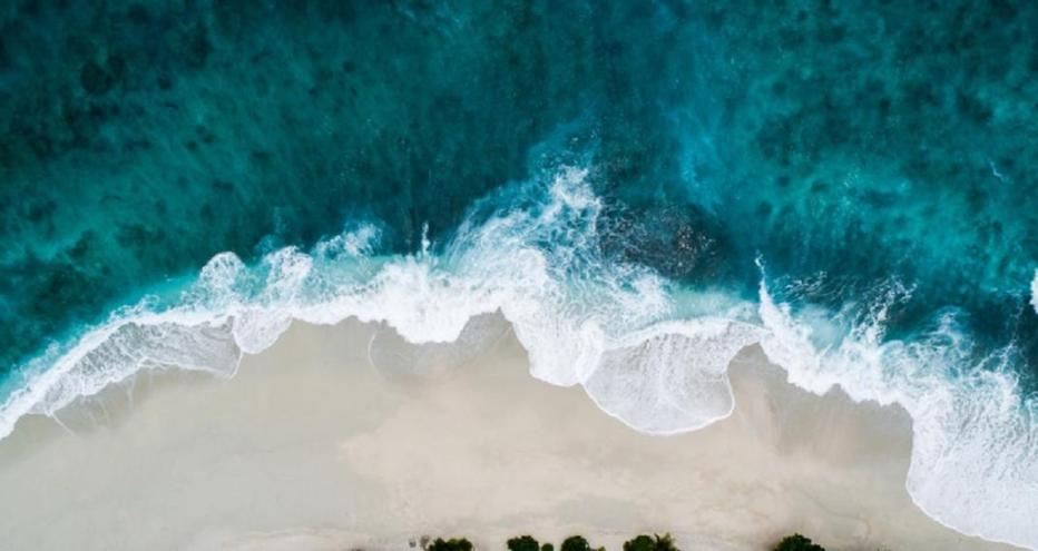
inches of rain hit parts of Belize every year during the rainy season
“The coast is a highly dynamic, constantly changing environment, and the potential impacts of future climate change and sea level rise, exacerbate the management challenge which that presents. A sound scientific foundation is key for reliable decision-making, but in many parts of the world available data is scarce and of unknown quality. We’ve used state-of-the-art satellite image analysis techniques to rapidly develop a range of key data sets, from topography and bathymetry to water quality and land use – all at a fraction of the typical cost. This enabled us to develop a coastal resilience strategy for Corozal Bay that we, and the stakeholders, are confident in, and provides a legacy of high-quality data with which this unique coastal area can be better managed into the future.”

Adam Hosking
With an aim to increase tourism’s contribution to national economic growth in an environmentally and socially responsible manner, the Government of Belize and the Inter-American Development Bank (IADB) teamed up to form the Sustainable Tourism Program (STP).
The first phase of the program, which took place from 2009 to 2013, focused on supporting the improvement, restoration and diversification of overnight destinations and their products; and strengthening national capacity for sector policy, destination planning and management.
Phase two of the STP, underway now, is building on this success to further increase income, revenue and employment opportunities within the tourism sector; and promote disaster and climate resilience, and environmental sustainability in tourism destinations to improve the governance of the industry and fostering an enabling environment for investment opportunities.
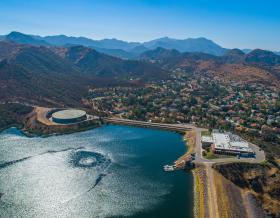
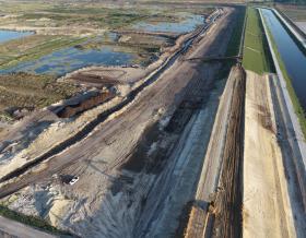
As part of the STP’s second phase, the Government and IADB commissioned Jacobs to develop a Shoreline Management Plan to improve disaster and climate resilience along 85-kilometers of coastline in northern Belize in the Corozal District – where there’s a strong tourism potential but heightened coastal risk.
Infrastructure developments in places like Corozal Bay face detrimental threats from even slight rises in sea levels. Just a single meter of sea level rise is estimated to cause loss of more than 2 percent in GDP – primarily from lost tourism.


In developing the shoreline management plan, our team led the planning and design of four demonstration nature-based shoreline stabilization projects; engagement of community groups and other stakeholders to inform development of outputs; and socio-environmental, economic and financial feasibility studies to ensure sustainability of all recommendations.
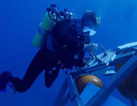
To provide a long-term framework for risk-informed development control and engineering, based on a detailed understanding of coastal hazards and how these may evolve with future climate change, we tapped into the power of cutting-edge technologies for resilience modeling. These technologies included taking to the skies – using unmanned aerial vehicles (UAV) or drones, to conduct shoreline surveys – and putting data gathered from our partner’s satellite imagery to work, analyzing the imagery to derive land use, water quality, marine and terrestrial habitats, bathymetry and topography data to guide our coastal modelling and risk definitions.
Using this data, we made recommendations for coastal resilience priority areas, targeting support for tourism and economic growth and developed preliminary shoreline stabilization designs for four locations, integrating nature-based approaches and complementary non-structural measures for the following outcomes:
Alongside the Government of Belize and the IADB, we developed the shoreline management plan with extensive engagement of the Corozal Bay Local Tourism Committee, including providing capacity building training on the application of the data products and delivering climate resilience.
The first Shoreline Management Plan developed in the region, this project supports the economic growth of Corozal Bay and provides a framework for improved coastal risk management throughout Central America and vulnerable coasts worldwide. Don’t believe us? Take it from the Climate Change Business Journal, who awarded the plan with one of its 2018 Project Merit awards in the climate change resilient infrastructure category or Flood & Coast, convened by the Environment Agency, which named the project its 2019 International Project Excellence Award winner.
