


Q&A
Dec 13, 2022
-
Save to favoritesShare with your friends
-
We’re living in the era of digital disruption, and we need bold digital and technology leadership now more than ever before. Leading this change demands knowledge, imagination, new thinking, an appetite to reinvent and the courage to challenge conventions.
In this series, we're celebrating our team of digital and technology specialists and visionaries, spearheading the development and delivery of our technology-forward solutions for smarter working and better living in Asia Pacific and the Middle East.
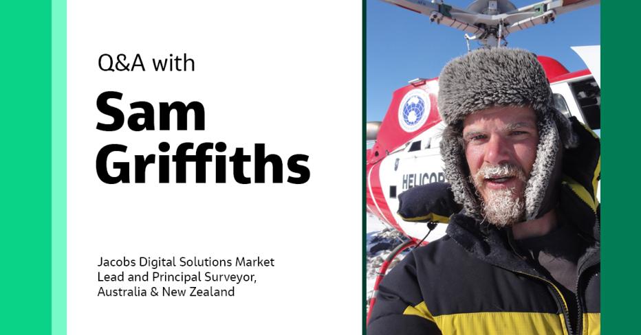
For this feature, we caught up with Digital Solutions Market Lead and Principal Surveyor in the Australia and New Zealand (ANZ) region Sam Griffiths, to discuss how digital technologies like Building Information Modeling (BIM) and digital twins are making the Architectural Engineering and Construction (AEC) industry ready for the digital age, the real value of geospatial data and why geospatial intelligence is indispensable for the digital economy.
Let's get to know Sam:
Hi Sam! You have been with Jacobs for over ten years, so tell us a bit about your career background and role at Jacobs.
As a geomatics graduate, I started with Sinclair Knight Merz (SKM) in 2004 across both geospatial and survey disciplines. I was fortunate enough to have the opportunity to travel and work across a range of overseas projects. From there, I joined the geophysical exploration industry, working globally on primarily offshore projects, before coming back into the scientific Earth Monitoring community with Geoscience Australia.
While loving the technical challenges within the surveying and spatial community, I did have a particular interest in business management and a desire to get back into the consulting landscape. So, I moved back to SKM in 2011, which was later acquired by Jacobs. Since returning I’ve gradually gravitated toward market and business development-type roles, which I thoroughly enjoy.
Why are geospatial technologies crucial for the digital transformation of the infrastructure industry, and how can they facilitate sustainable development?
Geospatial information, and its analysis, provide an essential reference frame to better relate to and adopt digital information. If that sounds broad, it’s because it is meant to be, as digital success — whether it be in an engineering or operational and maintenance focus — is enhanced by geospatial technologies. You only need to refer to the many technological progression examples to see that the future vision of ”digital”’ is tied to the reality in which it exists.
Geospatial technologies and the infrastructure supporting positioning have quickly come a long way. We’ve been ahead of the curve somewhat — and now digital systems, computing power and adoption are catching up and leveraging the benefits of reality capture and spatial analysis. The infrastructure industry is realizing these benefits within contexts such as digital engineering, where geospatial information is more manageable to assess against the full complement of an infrastructure asset's life cycle (i.e., plan, design, construct, maintain and decommission). This makes questions relating to sustainability through asset life cycle far easier to address, as you can relate any number of parameters via a standard reference frame within a common data environment.
How have digital technologies like BIM and digital twins made AEC industry ready for the digital age?
There has been an increasing convergence of capabilities as these technologies have matured over the last 15 years.
While admittedly, BIM and digital twins can be described in many different contexts, the overarching trend is the adoption of digital capabilities (visualization, real-time, analytics and scenario modeling) within a common platform. Most BIM and digital twin implantation measures capture a few of these capabilities. Still, as the technology curve continues to train, we are starting to see the actual end-to-end environment envisioned.
This can serve both broad and detailed functions by bringing many disciplines together in an interoperable way.
For example, within a design/construct focus, such platforms can greatly enhance quality assurance, project delivery staging, safety and value. Applied more broadly and at a larger scale, these platforms remove silos and create opportunities to deliver projects with greater awareness of social, environmental and economic measures.
All this is very exciting, even if we are all a little buzzword fatigued for now.
“Geospatial information, and its analysis, provide an essential reference frame to better relate to and adopt digital information. You only need to refer to the many technological progression examples to see that the future vision of ‘digital’ is tied to the reality in which it exists.”

Sam Griffiths
How have digital technologies like BIM and digital twins made AEC industry ready for the digital age?
There has been an increasing convergence of capabilities as these technologies have matured over the last 15 years.
While admittedly, BIM and digital twins can be described in many different contexts, the overarching trend is the adoption of digital capabilities (visualization, real-time, analytics and scenario modeling) within a common platform. Most BIM and digital twin implantation measures capture a few of these capabilities. Still, as the technology curve continues to train, we are starting to see the actual end-to-end environment envisioned.
This can serve both broad and detailed functions by bringing many disciplines together in an interoperable way.
For example, within a design/construct focus, such platforms can greatly enhance quality assurance, project delivery staging, safety and value. Applied more broadly and at a larger scale, these platforms remove silos and create opportunities to deliver projects with greater awareness of social, environmental and economic measures.
All this is very exciting, even if we are all a little buzzword fatigued for now.
How are machine learning and artificial intelligence (AI) revolutionizing geomatics?
Based on my direct knowledge, which is admittedly only a tiny fraction of the open possibilities, MI and AI lend themselves very well to ingesting significant quantities of real-time or near real-time data that enhances the ability for insights and analytics. I’m more familiar with this from an operation and maintenance perspective. When you consider the availability of the Internet of Things (IoT) and other data capture sensors that are underpinned by that geometric framework from the measurement sciences of geomatics, the application to move beyond pure analytics into tangible actions (i.e., maintenance needs) is extremely exciting across all major industries.
The future is now!
Data solutions are central to Jacobs’ new strategy. What is the power of geospatial data in the digital economy?
Geospatial data is the binding framework. It is a mechanism to access greater insights into the digital economy and is applicable on almost every level.
There are many complexities to geospatial — and we, as geospatial professionals, can sometimes spin our wheels a little debating these intricacies. But for the most part, I always struggle to see how a geospatial element can’t enhance just about every touch point of the modern economy (which, admittedly, is biased).
With the convergence of data capture, IoT, mass data handling, AI, ML and many other components, there is undoubtedly an array of fascinating opportunities ahead. I’m a huge fan of how Jacobs addressed its transformation over the last few years — it was a very progressive step, and from a market lead point of view, it’s exciting to start realizing the dividends.
Tell us about a career moment you’re most proud of.
I’ve had an incredible run working across the globe, the highlight of which is having an opportunity to work with interesting and remarkable people from all walks of life.
I’m thankful to have been part of the Asia Pacific survey team legacy, dating back to the early 2000s and I’m very proud of how we worked collectively to maintain relevance to align with the next generation of opportunities. It’s been challenging but rewarding in a fast-paced and dynamic environment where we far exceeded our visions even five years ago.
If you could provide one key piece of advice to young geospatial professionals, what would it be?
Never be afraid to fail and always look outside the bubble — we’re a cross-market/discipline with applications relevant to just about anything. This requires testing the unknown, getting out and about and understanding how markets are connected. While sometimes daunting, it’s a fantastic feeling to find relevance and connection to areas previously unaddressed.
-
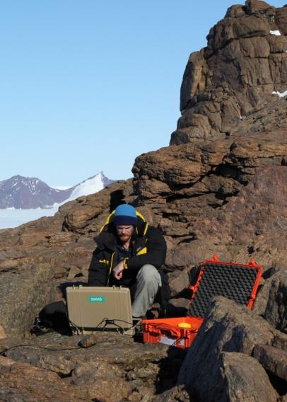
Mt Fang – Mawson Antarctica
-

-

Sophie, Vivienne and a proud Dad
People would be surprised to know that …
I’m a huge history buff with a keen interest in anthropology and am very fond of the performing arts. But Footy is still number one!
If you aren’t in the office, what would we most likely find you doing?
I’m at the beck and call of my two daughters (Sophie and Vivienne) and two dogs (Gary and Tommy). Still, when I have time to myself, it’s perhaps best explained that I’m holding a candle to my miss-spent youth and reinvigorating my poor surfing, guitar and boxing skills.
What do you enjoy most about being part of #OurJacobs?
What has given me the greatest enjoyment throughout my Jacobs career, and continues to give me enjoyment today, is bringing enthusiastic and smart people into positions where they can do inspiring work that they thoroughly enjoy.
About the interviewee

Sam Griffiths is an experienced surveyor with nearly 20 years of experience across the geospatial industry. He has built his professional career through involvement in survey and spatial specialist consultancy, project and team management, and business development.
Sam has recently combined this experience in his role as market lead for digital solutions, drawing upon his working relationships and industry connection to represent the digital disciplines across key markets.
His experience, personality and business acumen enable him to be an effective conduit between clients and technical solutions, creating opportunities to implement step changes as the industry adapts to a changing digital landscape.
You might be interested in...
-

 News
NewsProduct Development in Age of Digital Disruption: A Q&A with Paul Roberts
For this feature, we caught up with Paul Roberts, our manager of digital products in the Australia-New Zealand region, to understand how digital products align with Jacobs’ vision to become a global solutions advisor and provider and how data solutions help leverage the power of digital and data to help solve the world’s most critical challenges.
-
 Page
PageData Solutions
A forward-thinking solutions integrator with an expanding product suite and diverse portfolio, Jacobs understands what it means to perform in the most demanding data environments across the globe.
-
 News
NewsBoldly Moving Forward with Digital Solutions and Advisory in Asia: A Q&A with Rajitha Herath
For this feature, we caught up with Rajitha Herath, recently appointed as Jacobs’ Digital Operations Lead for East and Southeast Asia to learn more about his new role, his vision for Jacobs’ digital portfolio over the next five years, memorable projects and more.
Join #OurJacobs team
What drives you drives us as we work to build a better world – together. At Jacobs, every day is an opportunity to make the world better, more connected, more sustainable. We’re always looking for dynamic and engaged people to join our team. Bring your passion, your ingenuity and your vision.
