


Projects
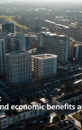
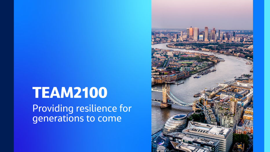
TEAM2100: Providing resilience for generations to come
Major flood risk management program is working to provide better tidal protection to London and Thames Estuary
-
Save to favoritesShare with your friends
-
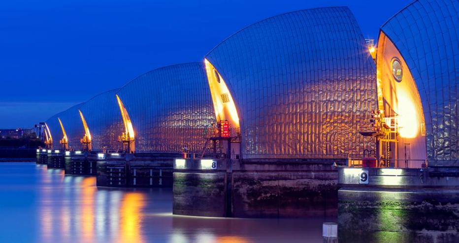
Thames Estuary Asset Management (TEAM 2100) was set up by England’s Environment Agency to create a long-term approach to managing tidal flood defenses in London and the Thames Estuary, including the iconic Thames Barrier. Jacobs is managing the first 10 years of the program.
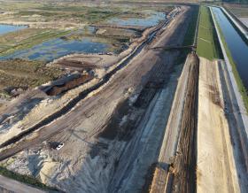
Working collaboratively as an integrated delivery team with the Environment Agency and Balfour Beatty, our job is to plan, inspect, refurbish and improve flood defenses along 330-kilometers of the River Thames and reduce the risk of tidal flooding to protect some 1.4 million people, over 4,000 different assets and over $396 billion (£321 billion) worth of property in London, Essex and Kent. This is part of the Thames Estuary 2100 Plan, which will adapt the riversides to rising sea levels over the next 100 years.
TEAM2100 advocates a programmatic approach to managing tidal flood defenses, aspiring to reduce the overall costs by seeking to invest in the right places at the right time. This major program also aims to deliver greater value for public money through innovation, and greater collaboration and joint planning with the supply chain. The program has maintained its ISO55000 asset management accreditation, reflecting an international standard for asset management.
-
1.4 M
people who live along the River Thames and its tributaries protected
-
$ 396
billion or more of property along the river is protected with this vital flood scheme
-
4 K
assets maintained throughout the estuary
-
30 +
years old – the average age of the current defenses. In some cases, assets are more than 100 years-old
A first-of-its-kind program
Tidal flood defenses need to protect London and the Thames Estuary from both a predicted rise in sea level and potentially higher and more frequent ‘storm surges’ (temporary further rises in sea level caused by certain weather conditions over the North Sea). Sea level rise in the Thames Estuary over this century could be between 20-88 centimeters[1].
Our work on TEAM2100 is the first of its kind on an estuary in Europe. It’s not just the scale and diversity of the river which makes managing its flood defenses challenging. The river is an ever-changing setting to work in, with a riverbed that literally shifts during the work. The flood defenses comprise more than 330-kilometers of walls and embankments and over 400 other structures, such as flood gates, outfalls and pumps. Many of them are over 30-years old, and in some cases over 100-years old. The investigations are providing information about the condition of individual defenses and about the system.
The effort includes design and development of an extensive flood management program — the largest U.K. program of its kind — incorporating a series of fortifications, embankments, flood gates, pumping stations, outfalls and major barriers to protect London, Essex and Kent from tidal flooding along the River Thames. Continued maintenance, essential asset improvements and environmental upgrades are benefiting people and wildlife along the tidal corridor.
As the lead delivery partner, we bring together a diverse team of experts in asset management, program management, engineering and construction to deliver integrated and sustainable solutions to complex problems in unique physical environments. We are always learning from experience — both successes and challenges where things didn’t go to plan — and applying the learning so that we are continuously improving the way we work together and what we deliver. Having an integrated team with the client, consultant and management contractor enables a shared vision and collaborative working to find the best approaches to delivering quality outcomes safely.
Award highlights
- Royal Society for the Prevention of Accidents (RoSPA) Gold Award 2022
- Flood & Coast Excellence Awards 2020 – Digital Excellence Winner
- Institution of Civil Engineers (ICE) London 2019- Team of the Year
- British Construction Industry (BCI) Awards 2018- Digital Transformation Initiative of the Year Award
- Institution of Civil Engineers (ICE) London 2018 -Innovation Award
- RoSPA Silver Award 2018
- The Environment Agency’s Project Excellence in Innovation Award 2017
- Esri U.K.’s Customer Success Award for Innovation in Field Data Collection 2017
- Institute of Asset Management’s 2017- Project Team of the Year
- New Civil Engineer’s Tech Fest Awards 2017: Project Team of the Year and Innovation of the Year: Big Data
- USA Resilience and Climate Adaption 2017- Consultant Award of the Year
You might be interested in...
-
 News
NewsTransforming Internal Engagement on TEAM2100: A Q&A With Claudia Beer-Davies
Climate change has intensified flood frequency and risk, and our urban areas — including our major cities — are under threat. TEAM2100 is a pioneering flood defense program that harnesses the latest talent and technology in an integrated delivery team, but its success relies on seamless stakeholder engagement and communication. Claudia Beer-Davies shares her insights in driving both.
-
 News
NewsSafeguarding London's Future Through Talent & Teamwork on TEAM2100: A Q&A With Claire Bishop
Pivotal major programs such as TEAM2100 offer the chance to solve some of the world’s greatest challenges. However, while this potential is unmatched, so is the scale of the problem. To conquer this, a potent combination of talent, technology and track record is required, along with the highest level of stakeholder collaboration. Claire Bishop shares her insights into raising — and maintaining — this high-level, outcome-led approach.
Future Foundations.
Co-creating the world to come

From developing climate resilience and transitioning to a low-carbon future, to modernizing and transforming infrastructure, governments and businesses face critical challenges. How they respond will define our future.
As our clients navigate these challenges, we help them think differently – working together to pioneer tomorrow's infrastructure solutions and build the foundations for a prosperous, secure future.
