Jacobs is providing expert support to the Environment Agency on three key national projects: National Flood Risk Management 2 (NaFRA2), Long-Term Investment Scenarios (LTIS) 2025 and National Coastal Erosion Risk Mapping 2 (NCERM2), which will ensure long-term resilience to the U.K. environment and communities.
National Flood Risk Management 2
Together with the Environment Agency, JBA Consulting and a small group of industry and academic experts, we are designing, developing and implementing the National Flood Risk Assessment 2 (NaFRA2), a pioneering cloud computing system that will help create a step-change in the quality and scope of England's national flood risk information.
Two years into the five-year project, we are progressing this important and time-sensitive effort, which will support a wide range of Environment Agency flood risk management activities – from national evidence and strategy to local community, property and asset-level risk information. NaFRA2 will bring together vast quantities of diverse data – modelling, properties, terrain and third-party data – to tell a coherent story about risk at any scale and anywhere in England. As well as the richness of the data and breadth of scenarios represented by NaFRA2, it is differentiated by being a live system that will continue to be updated with new data and methods to meet the evolving needs of its users. We are engaging with the Agency and its wide base of users as key stakeholders to ensure that the system and its data can be intuitively accessed to meet a broad range of business needs. Although we are used to working on complex projects, this is a unique combination of challenging scalable data manipulation, cutting edge method implementation, user-focused design and national-scale flood modelling. Considerations of how this tool can stand the test of time, making it usable in decades to come to help manage flood risk, including from climate change impacts, are at the heart of this work.
“As an organization, the Environment Agency has always been very good at producing numerous models and data nationally and locally,” says Environment Agency Project Executive Ben Lukey. “NaFRA2 is going to help us make much better use of what we have, providing for the first time a mechanism for selecting the right model outputs to provide the best flood risk information for any location. Two years into the project, it’s brilliant to now see early prototypes of the interface emerging. I’m particularly excited to be able to show users how we’ll be able to share information about future flood risk as climate change starts to have a serious impact, to give everyone a chance to adapt to increasing flood risks and build resilience.”
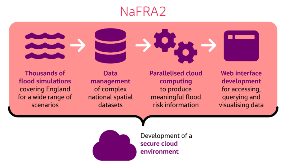
Development of a secure cloud environment through NaFRA2
Long-Term Investment Scenarios 2025
The Long-Term Investment Scenarios (LTIS) program seeks to understand the national-scale investment needs to manage flood risk in England, providing a critical evidence base for the Environment Agency’s national business and helping it to secure government funding for flood risk management. Making full use of NaFRA 2 and National Coastal Erosion Risk Mapping 2 (NCERM2), this project looks beyond the present day to understand how risk and flood and coastal erosion management investment needs would evolve under different scenarios over the next 100 years.
LTIS explores the value of investment through a range of climate change, development control and investment scenarios. LTIS 2019 expanded on previous work by exploring more extreme climate change scenarios, more realistic development control scenarios, an expanded range of responses and a more detailed exploration of wider impacts. LTIS 2025 in contrast is a whole-scale refresh, improving methods, being aligned to the Environment Agency’s Flood and Coastal Erosion Risk Management (FCERM) Strategy and making use of the latest R&D.
This new analysis will push the boundary of what is possible through the LTIS framework, by adopting innovative methods and data analysis coupled with digital tools for communicating results.
Working in partnership with the Environment Agency, JBA Consulting, Horritt Consulting and Sayers and Partners, Jacobs is providing expert advice on a number of interconnected topics, including climate change, flood and coastal resilience and adaptive planning. We’ve been involved with the LTIS program since its inception in the mid-2000s.
“We are looking forward to working together on some challenging and ambitious questions on this project,” says Environment Agency Project Executive Dr Mike Steel. “This will enable LTIS 2025 to make significant advances in our understanding of future policy and investment choices, to improve resilience and adaptation to future climate risks.”
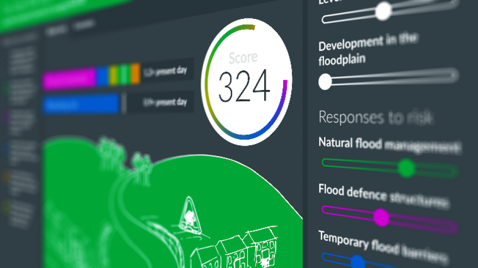
LTIS2019 visualization of concept
National Coastal Erosion Risk Mapping 2
England’s coasts are vulnerable to sea-level rise and climate change events. In order to be prepared for and mitigate such events, the Environment Agency has commissioned Jacobs, supported by Royal HaskoningDHV and Channel Coastal Observatory, to update the prediction of long-term coastal erosion risks through the National Coastal Erosion Risk Mapping (NCERM2). The NCERM2 output will also provide the coastal industry, public and local planners with an easily accessible online tool within the new Shoreline Management Plan Explorer (currently being developed by Swirrl) to see the risk from erosion.
Jacobs has been involved with this project for over 15 years, leading the project team to improve the technical reliability of NCERM2 by bringing the scientific methodology and the currency of erosion predictions for England up to date. We are helping the Environment Agency bring together datasets from national and local sources, including local authorities.
NCERM2 will work hand in hand with LTIS and NaFRA2 to provide a reliable and adaptable national dataset to enable flood and erosion risk management decision-making.
“The recently launched FCERM Strategy Roadmap to 2026 sets out how we will work with partners to ensure we meet the strategy’s long-term ambitions,” says Environment Agency Project Executive Nick Hardiman. “Updating NCERM and its assessment of properties and infrastructure at risk from erosion in a changing climate is a key objective in delivering our FCERM Strategy. We are delighted to be working with Jacobs, Royal HaskoningDHV and Channel Coastal Observatory on this project, with the breadth of experience that they bring across NCERM, Shoreline Management Plans, and the wealth of data and coastal monitoring knowledge from the National Coastal Monitoring Program.”
“Through involvement with these projects and programs, we are helping create a resilient future for our places and communities,” says Jacobs People & Places Solutions Vice President Bruce Chalmers. “Combining leading expertise in flood risk management with industry partnerships, underpinned by a collaborative approach and enabled by data solutions, makes possible the realization of a shared vision to protect and enhance our living environment.”
You might be interested in...
-
 News
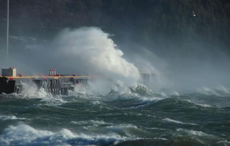
NewsHow Flood Resilience and Big Data Combine for Fast Answers, Anywhere
Globally, flood frequency is predicted to increase across 42% of Earth’s land regions by the end of the century. What if we showed you how, at the click of a button, Jacobs’ game-changing Flood Cloud service provides dynamic, on-demand access intelligence to promote resilience against climate threats?
-
 News
NewsJacobs Secures National Flood Risk Assessment 2 (NaFRA2) Contract
Jacobs was selected by England's Environment Agency to design, develop and implement the National Flood Risk Assessment 2 (NaFRA2), a pioneering cloud computing system that will help create a step-change in the quality and scope of England's national flood risk information.
-
 News
NewsInnovative, Sustainable Flood and Coastal Erosion Risk Management
As our appreciation of future uncertainty grows, adaptive planning is becoming routinely considered as an alternative to more traditional flood and risk management approaches. We are working to ensure the long-term resiliency and cost-effectiveness of planning decisions we make today. Read more about this work on three strategically important flood risk protection projects in the U.K.
-

 News
NewsSuccess for Jacobs at Women in Flood and Coastal Erosion Risk Management Awards
Jacobs has been awarded the first organizational Women in Flood and Coastal Erosion Risk Management Award, in recognition of our leadership in inclusion and diversity.
-
 Report
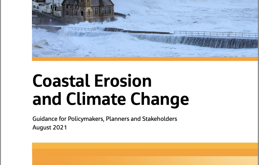
Coastal erosion and climate change
Climate change is a global problem that will result in severe consequences at the coast. Strategic coastal planning, management and adaptation are key to mitigating future losses and ensuring that coastal development and communities are sustainable in the long-term.


