


News

While the competitive Rio FIFA World Cup, Sochi Winter Olympics and the devastating Ebola health crisis dominated headlines in 2014, the world quietly hit another major milestone: more than half of the global population was living in urban areas for the first time.
During the next four years, urbanization would lead to the number of megacities, or cities with populations higher than 10 million, rising from 28 to 33 in 2018. Of these megacities, just about half lie at risk from sea level rise, increased storm surges and extreme weather events. In more rural populations, especially in low-lying island nations, climate variability further threatens life-sustaining activities.
In 2012, Hurricane Sandy made landfall, affecting 24 U.S. states and causing some $70.2 billion in damage. More than 15,000 flights into New York and other East Coast airports were canceled. New York subways were flooded with millions of gallons of seawater and sustained the worst damage in its more than century of service. Bridges and roadways flooded and were closed across the eastern seaboard.
Hurricane Sandy’s unprecedented destruction served as a wakeup call to New York City and other urban populations across the world – we need to strengthen our cities’ infrastructure to protect against a changing climate and intensifying extreme weather events, and refresh our focus on preparedness, response and recovery planning and delivery to emerge stronger post-events.
What if we showed you how Jacobs is providing comprehensive solutions to help communities prepare, adapt, mitigate and recover when facing weather-related mobility challenges?
in estimated global economic costs of extreme weather, including significant recovery, repair and future-proofing costs for transport
resilience-based projects in the Jacobs portfolio around the globe
“Anticipating and responding to both natural and man-made disasters or accidents to provide safe, reliable and resilient solutions is fundamental to how we deliver transport solutions to users and our clients.”
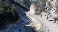
In the fall of 2013, devastating floods caused nearly $4 billion in widespread damage to critical infrastructure, transportation networks, homes and businesses across 24 counties in Colorado.
Especially destructive for mountain and rural corridors north of Denver, floods in the Big Thompson River canyon destroyed more than 10 miles of the U.S. Highway 34 roadway embankment, washed out homes and took the lives of two.
Due to road damages, residents in the canyon were cut off from emergency services and more than 2,000 people needed to be evacuated to safe areas via helicopter.
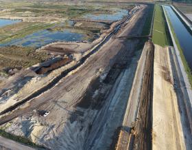
Looking for a long-term, resilient solution, the Colorado Department of Transportation, inspired by Colorado Governor Hickenlooper’s commitment to “build back better than before,” engaged us to design 23 miles of repairs to US 34, aimed at implementing a more resilient roadway and prioritizing emergency access for the residents in the next flood event.
As infrastructure is increasingly impacted by natural disasters and agencies are challenged to do more with less – incorporating flexible and innovative solutions is key to more resilient upgrades, and quicker, lower-cost repairs in the event of future devastation. We implemented several innovative and resilient solutions on the now multi-award-winning project, setting a model for future-focused transportation improvements aimed at enhancing safety. Discover more here.
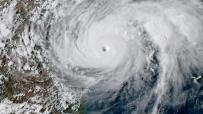
At an estimated $125 billion in damage, Hurricane Harvey is the second-most costly hurricane along the mainland since 1900. Causing about $125 billion in damage, Hurricane Harvey ranks as the second-most costly hurricane to strike mainland U.S. since the early 1900s.
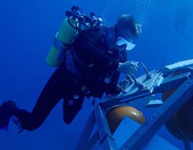
The disastrous storm brought a normally bustling Houston transportation hub to a standstill. Floods soaked and inundated infrastructure, closing three ports and deeming more than 780 roadways impassable – causing headaches for commuters and the cargo industry alike. Nearly 10% of the U.S. trucking industry was estimated to experience impacts from the storm at its peak. The Houston Ship Channel lost three feet of depth – previous studies found that losing just one costs the economy up to $280 million annually.
The Federal Emergency Management Agency (FEMA) launched one of its most historic disaster responses ever, which continues today. Our joint venture company, CCPRS, continues to provide technical expertise to support FEMA’s Hurricane Harvey Public Assistance Program, which awards grants to state and local governments, and certain private non-profit entities.
Our work encompasses engineering, cost estimating, construction management and other technical services to support disaster response and recovery efforts including debris removal, emergency protective measures and permanent restoration of damaged infrastructure, including roadways. The program also encourages protection of damaged facilities from future events by providing assistance for hazard mitigation measures during the recovery process. Under a preceding concert, we provided more than $500 million in public assistance, recovery operations, construction and project management and technical services, including recovery support to Puerto Rico in response to Hurricane Maria. Discover more here.
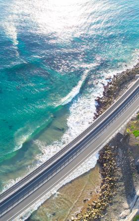
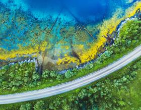
When it storms in New Zealand, low-lying coastal areas, like those along the West Auckland coast, can quickly become inundated, or flooded, by the sea. Sitting along this vulnerable coast is Auckland’s Northwestern Motorway (SH16). Built in the 1950s on soft marine mud, coastal erosion and land subsidence over the years has caused the motorway to slowly sink, leaving it particularly susceptible to flooding, especially in high tides.
To safeguard and futureproof SH16 against flooding and coastal erosion, the New Zealand Transport Agency procured a strategic alliance team, including us, to raise and widen 4.8 kilometers of the existing twin three-lane motorway.
Careful environmental consideration underpinned the effort – which included geotechnical, structural, roadway, environmental and drainage design to secure the roadway – as SH16 runs along the sensitive coastal environment of the Motu Manawa Pollen Island Marine Reserve. Doing our part to impact the reserve as little as possible, we undertook the detailed geometric design and traffic services of permanent and temporary alignments of the motorway, interchanges, and pedestrian and cyclepaths to minimize the project’s footprint in the reserve. Additionally, the stormwater drainage system, designed by the project team, significantly narrowed the roadway’s embankment width, reducing costly ground improvement works and required fill materials above sensitive environmental areas, and ultimately secured an estimated $50 million in savings. We also prepared the suite of revised environmental management plans for the design and construction of the effort, including taking critical cues from existing project efforts in relation to managing sensitive coastal and marine reserve areas and community concerns.
Now complete, the widened SH16 roadway is bolstering the coast’s ability to mitigate flooding and subsidence, and offers citizens improved travel time reliability, improved pedestrian and cyclist access and more direct bus trips thanks to the addition of dedicated bus shoulder lanes along the roadway. And, SH16 represents a key connection in the Western Ring Route, which upon expected completion in 2021, will offer an alternative route around Auckland for improved network efficiency and regional growth.
