


News
Feb 11, 2021
-
Save to favoritesShare with your friends
-
Cities around the world are facing unprecedented levels of change. The usual drivers – a warming climate, rapid population growth, urbanization, and advances in technology – have been exacerbated by COVID-19, exposing social inequality and reminding us of just how connected we all are.
So how does a city go about assessing its current condition and building a path to a better, more resilient and sustainable future? It does it through strong leadership, vision and transformative digital technologies like geodesign.
Geodesign is a powerful planning method that uses stakeholder input and spatial analytics to simulate the possible impact of alternative design scenarios. It blends the ‘science of GIS’ with the art of design, enabling participants to objectively look at the world as it is, and as it could be. We are basically talking about intelligent, values- and data-driven scenario planning.
This holistic, interdisciplinary approach to planning and design makes it possible to balance quality of life indicators like safety, access to parks, transit, school, healthcare, food and jobs, with sustainability and resilience goals to maximize the number of positive outcomes for the most people. The result, a great place where all people can live, work, play and thrive.
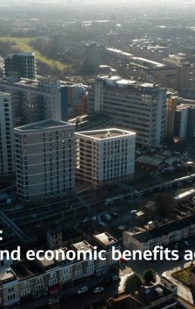
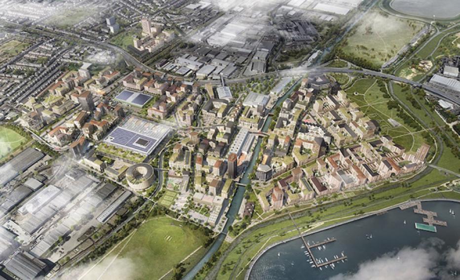
And nowhere have these elements come together more beautifully than at Meridian Water.
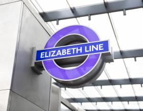
The Meridian Water redevelopment project is a major £6 billion ($7.75bn), 20-year London regeneration program led by Enfield Council, bringing 10,000 homes and 6,000 jobs to the London Borough of Enfield, north London. Alongside beautiful homes and world-class public spaces and community facilities, the 200-acre development will have its own brand-new railway station, linking commuters to the region.
Jacobs is partnering with Enfield Council to provide program and master plan leadership, technical design and planning advisory services for the development of a new masterplan for Meridian Water. We are also providing client technical advisory service across several disciplines during the design and delivery of over $150 million of strategic infrastructure works to help unlock the Meridian Water site.
We are also creating the data visualization platform and KPI-driven geodesign processes required to synthesize data coming from multiple sources into a common and connected framework to support decision-making.
The result is a set of live, interactive 2D and 3D dashboards and models to help optimize the master planning process to ensure that it delivers on the vision and meets the sustainability and resilience goals set forward by the council, including: 1) a vibrant mix-use development with access to parks and green infrastructure for flood control combined with multiple well-being benefits, 2) access to multi-modal transit and pedestrian-friendly streets, and 3) a vibrant setting for ‘making and create, with workshops, shops, restaurants and businesses with ample affordable housing.
The benefits to the geodesign approach are many, including:
- Increase design efficiency saving time and money.
- Improve communication using visually compelling content.
- Enable innovative solutions through realized synergies.
- Increase speed of data sharing, reporting, and the surfacing of issues.
- Improve transparency and trust.
- Justify decision-making using a documented and data-driven approach.
The smart, sustainable, resilient communities of the future will require smart planning methodologies like those being employed at Meridian Water. To learn more about geodesign, lessons learned and how you might chart your own path to digital transformation watch the ‘Meridian Water – Sustainable and Resilient by Design’ presentation given at the Esri 2021 Geodesign Summit.
About the presenters
Shannon McElvaney, Global Director of Geodesign, Colorado, U.S.
Shannon is the Global Director of Geodesign at Jacobs where he focuses on integrating spatial analytics and geodesign processes with planning and design to help clients create a more sustainable, resilient built and natural environment. He is passionate about the power of interdisciplinary, data-driven and values-driven spatial simulations to test “what if” scenarios to increase design efficiency and innovation, while maximizing positive outcomes.
Shannon has 27 years of experience applying the use of geospatial technology across numerous industries including planning, utilities, transportation, natural resources, conservation, agriculture, and renewable energy. In addition, he has published many articles on the use of geospatial technology and is the author of the book 'Geodesign: Case Studies in Regional and Urban Planning'.
Mary-Jane Wood, Senior Urban Designer, Jacobs, London, U.K.
MJ has delivered a diverse range of master planning and urban design projects across a multitude of scales, from conceptual masterplans, to detailed place-making principles, design guidelines and strategic regional projects, in both local and international geographies. MJ looks to challenge the ways in which we can make the design process more innovative, inter-disciplinary and data-driven, by implementing bespoke digital tools and processes to projects.