


News
Dec 12, 2018
-
Save to favoritesShare with your friends
-
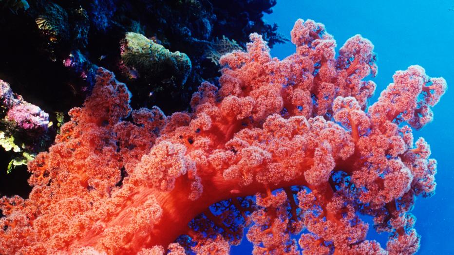
Deep beneath the ocean’s surface, vibrant coral reefs mesmerize the eye and mind with vivifying and effervescent color – at least, according to Pantone’s description of PANTONE 16-1546 Living Coral, its 2019 Color of the Year.
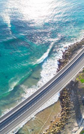
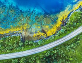
As the oceans and temperatures rise and wave energy increases because of climate variability, the world’s coral reefs – and their vivid color – are at risk. In fact, since a sizzling heatwave in 2016, coral bleaching events (or those that cause reefs to lose their color due to heat and acidity) have killed off nearly half of the Great Barrier Reef, the world’s largest and most extensive reef system.
About half of reef systems around the globe suffered similar devastation – and coastal communities are wondering how best to shore up their coastlines, reduce flooding and protect these valuable habitats for wildlife and recreation, says Jacobs Coastal Planning and Engineering Global Technology Leader Nigel Pontee.
“In the next few decades, communities won’t be able to ignore the effects of sea-level rise as millions of people will be impacted,” he shares. “Because of this, there’s more interest in quantifying the benefits of coastal habitats as natural flood and erosion defenses.”
Natural infrastructure solutions for coastal habitats – such as planting mangroves or installing new material for oyster or coral reefs – can augment and even offer an alternative to traditional grey engineering structures, like sea walls and levees that are widely used to manage flood and erosion risk. These green solutions can even be less expensive and more resilient than their traditional counterparts, offering enhanced coastal erosion, wave energy and flood risk reduction benefits while improving coastal ecology.
Natural infrastructure can help reduce wave energy and flooding in some settings; according to research by the World Bank Wealth Accounting and Valuation of Ecosystem Services, coral reefs can reduce wave energy by up to 97 percent. Reduced wave energy in turn lessens the risk of erosion and flooding during storm events – in fact, the WAVES research highlights that on an annual basis, coral reefs provide approximately $6 billion in coastal protection services.
But natural infrastructure alone is not a universal panacea to replace more traditional gray, "hard" infrastructure – where wave forces are high, near-shore water depths are great or the coastal strip is narrow, a hybrid approach (a combination of gray and green) is needed to create resilient coastlines.
“We’re seeing a big shift from smaller natural infrastructure projects created by scientists and local property owners to replace old bulkheads or other failing hard structures to more complex and ambitious coastal resilience efforts,” adds Pontee, who’s also a visiting professor of natural and environmental sciences at University of Southampton. “These projects require more science and engineering, combined, to drive the solutions.”
Such solutions include a land and urban development project on the Temaiku Bight in the Kiribati capital of Tarawa, aimed at assessing the feasibility of increasing the height of a 300-hectare area of land to approximately two meters above the highest measured sea level.
Kiribati, an atoll in the South Pacific, is one of the world’s most economically and physically vulnerable countries. Home to more than 110,000 people, Kiribati is made up of 33 low-lying coral atolls which, at their highest elevation, average six feet above sea level. During the next eight decades, the United Nations Intergovernmental Panel on Climate Change (IPPC) projects a three-foot increase in global sea levels. Kiribati’s surrounding sea levels, in comparison, are predicted to rise by up to 0.6 feet by 2030.
Of its 110,000 inhabitants, half live on the crowded capital island of Tarawa, which is increasingly impacted by sea level rise and the frequency of storm surge inundation, shares Jacobs Project Manager Simon Liddell.
“Tarawa’s population is rapidly growing due to migration from the outer islands, placing pressures on natural resources, infrastructure and essential services,” he adds. “What we’re doing on this project – reclaiming 300 hectares, or the equivalent of about 300 American football fields, of swampy inhabitable land and transforming it into an urban development resilient to predicted 2200 ocean levels – is the first large scale climate change adaption development of its kind for small island nations and a potential resilience trend for other low-lying locations.”
Teaming with the New Zealand Ministry for Foreign Affairs and Trade and the Government of Kiribati, Jacobs led the feasibility study and conceptual plan, including coastal engineering, urban and landscape design and environmental and social impact assessment. The project – also the largest-of-its-kind in the Pacific – included development of a conceptual land use plan to address resilience issues impacting the atoll, including rapid urbanization, limited water supply, ecosystem services and an increasing risk of land inundation from king tides.
Future climate variability isn’t the only factor putting coral reefs in danger though, cautions Ade Lambo, a marine science technical director and principal consultant at Jacobs.
“Some of the world’s most at-risk communities are low-lying coastal cities that, at the same time are, rapidly urbanizing,” says Lambo. “To help these locations adapt and become more resilient to the impacts of climate change as life on the coast requires, coastal engineering begins with engaging with the local populations to understand their social and cultural needs.”
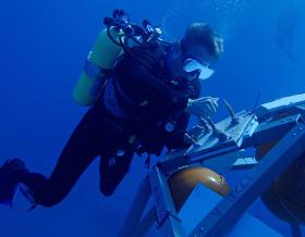
Such was the case for Christmas Island, a tiny Australian territory in the middle of the Indian Ocean. Located 1,650 miles from the country’s nearest western city, most of the island is a national park and is known for its unique annual red crab migration and extensive fringing coral reef system with some of the world’s steepest drop-offs – making it a popular scuba diving point.
Surrounded by a spectacular tropical reef that plunges into the ocean’s deepest point, Christmas Island is home to just over 2,000 residents, most of whom live on the island’s northern tip, a settlement called Flying Fish Cove. A large federal government contingent also resides on the island, including Australian Border Force, Australian Federal Police and Australian Navy.
Given its remote location, historic communications on the island were met by satellite, which provided a very low bandwidth at a high price. To better connect residents, including the federal government agencies who required more effective communication channels, Christmas Island began exploring bringing a fiber optic cable to the island. The optimum location for the cable landing though, on the shore of Flying Fish Cove, crossed directly over a well-developed coral reef which is heavily used for recreation by the residents of the island.
That’s where Jacobs came in, says Lambo, to survey the associated route, identify the constraints and seek alternatives.
“We understood, of course, the societal need to provide a better communication mobility across the island, but we also wanted to protect the surrounding reef, home to some of the most unspoiled corals in the world,” he shares. “These reefs, which provide significant coastal protection to the island, already face deterioration and bleaching risks from storm surges and climate variability, and it’s part of our duty – as planners, scientists, ecologists, engineers and general stakeholders – to develop solutions that are effective not only in reducing risks and vulnerability for people, but also the environment we live in.”
-
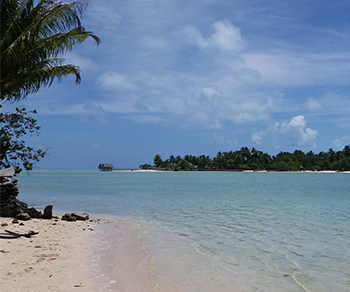
Home to more than 110,000 people, Kiribati is made up of 33 low-lying coral atolls which, at their highest elevation, average six feet above sea level
-
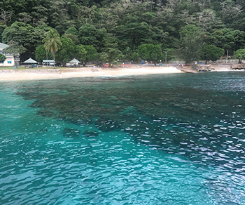
Surrounded by a spectacular tropical reef that plunges into the ocean’s deepest point, Christmas Island is home to just over 2,000 residents, most of whom live on the island’s northern tip
Globally, without reefs, the annual expected damages from flooding would double, and costs from frequent storms would triple, according to a recent study by Nature Communications researchers. For 100-year storm events, the study highlighted that flood damages would increase by 91 percent to a cost of US $272 billion without reefs.
“These astounding numbers emphasize why plans for coastal development, which may include such things as infrastructure development or recreation, should consider the risk reduction services already provided by existing habitats,” says Pontee. “Destroying coastal habitats can increase risk levels leading to increased economic damages and the requirement to install costly new defense structures, not to mention removing other valuable ecosystem services.”
Thankfully on Christmas Island, all turned out merry and bright. The Jacobs team identified a route with limited environmental sensitivities and the client adjusted the shore crossing route to align with the existing jetty structure and sandy channel, providing a faster, more reliable communications network for residents, and leaving the dazzling, colorful reefs around the island untouched – Living Coral in its most glorious state.
